Report: Want to Ease Commuter Pain? Highways and Sprawl Won’t Help

Imagine two drivers leaving downtown to head home. Each of them sits in traffic for the first ten miles of the commute but at that point, their paths diverge. The first one has reached home. The second has another twenty miles to drive, though luckily for her, the roads are clear and congestion doesn’t slow her down. Who’s got a better commute?
Shockingly, the standard method for measuring traffic congestion implies that the second driver has it better. The Texas Transportation Institute’s Urban Mobility Report (UMR) only studies how congestion slows down drivers from hypothetical maximum speeds, completely ignoring how long it takes to actually get where you’re going. The result is an incessant call for more highway lanes from newspapers across the country.
An important new report from CEOs for Cities, though, has laid out major problems with the UMR. It shows how commuters in compact regions, whose daily trips look hellish based on the UMR, actually spend far less time in the car than residents of sprawling metro areas.
The misleading metrics in the UMR are a convenient bludgeon for the highway lobby. According to report author Joe Cortright, the UMR serves as “a drumbeat saying we need to spend a lot more on expanding capacity. It gets used in political speeches, it’s used in lobbying.”
The key flaw is a measurement called the Travel Time Index. That’s the ratio of average travel times at peak hours to the average time if roads were freely flowing. In other words, the TTI measures how fast a given trip goes; it doesn’t measure whether that trip is long or short to begin with.
Relying on the TTI suggests that more sprawl and more highways solve congestion, when in fact it just makes commutes longer. Instead, suggests CEOs for Cities, more compact development is often the more effective — and more affordable — solution.
Take the Chicago and Charlotte metro areas. Chicagoland has the second worst TTI in the country, after Los Angeles. Charlotte is about average. But in fact, Chicago-area drivers spend more than 15 minutes less traveling each day, because the average trip is 5.5 miles shorter than in Charlotte. Charlotte only looks better because on average, its drivers travel closer to the hypothetical free-flowing speed.
For Cortright, perhaps the biggest problem with the UMR is that it suggests traffic congestion is always getting worse. “One insight from our reanalysis is that in some places it’s getting better,” he said, “and it’s getting better because people are changing the pattern of the trips they’re taking.” In Portland, Oregon, for example, the TTI got much worse between 1982 and 2007. But in fact, by reducing average travel distances from 19.6 miles to 16.0 miles over that period, Portland shaved 11 minutes of peak travel off its average commute.
The CEOs for Cities report also lists a number of methodological flaws with the UMR. For example, it doesn’t use observed speeds to calculate how much congestion slows down traffic during peak hours, but relies on a mechanistic model based on the total number of cars moving in a full 24-hour period. When showing the amount of gas that congestion wastes, it relies on an outdated study that incorrectly assumes faster speeds are always more fuel-efficient.

Read More:
Streetsblog has migrated to a new comment system. New commenters can register directly in the comments section of any article. Returning commenters: your previous comments and display name have been preserved, but you'll need to reclaim your account by clicking "Forgot your password?" on the sign-in form, entering your email, and following the verification link to set a new password — this is required because passwords could not be carried over during the migration. For questions, contact tips@streetsblog.org.
More from Streetsblog USA
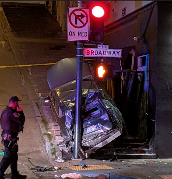
Motorist Careens onto North Beach Sidewalk, Killing Pedestrian
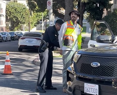
Driver kills pedestrian at another location where a safety project festered
The post Motorist Careens onto North Beach Sidewalk, Killing Pedestrian appeared first on Streetsblog San Francisco.